
Reviewed · SCENIC FLIGHTS
Mount Cook: Mountains High 40 minute Flight
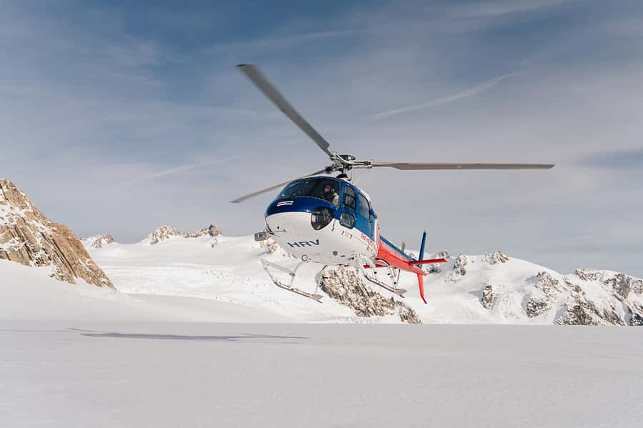
A helicopter flight over Aoraki/Mount Cook gives you a fast, clear look at New Zealand’s highest mountain, its huge icefields, and the remote country around it. The best moment comes when the helicopter settles onto a snowy alpine site, if snow levels and weather allow, giving you time for photos in the crisp mountain air.
I like the small six-person limit, which keeps the flight more personal and gives you a better chance of seeing out. I also like the route’s variety: Hochstetter Icefall and the upper Tasman Glacier on the way out, then the Burnett Mountains and dry Mackenzie Basin on the return.
The main caution is weather. Routes, flight times, and the landing can change at the pilot’s discretion, and a snow landing is not guaranteed. At $391 per person, this is a serious splurge, but it offers access to places most people cannot reach during a short visit.
Key points to know before you fly
- The snow landing is the highlight: You may step out at a remote alpine site for photos and mountain air, but snow levels decide if it can happen.
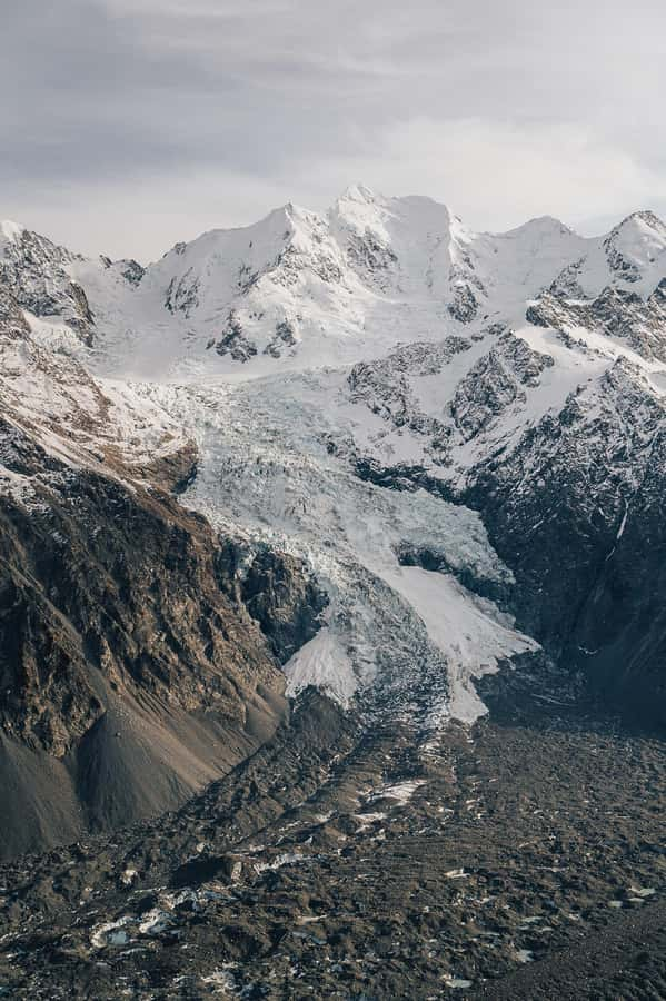
- The route covers several distinct regions: Look for Hochstetter Icefall, the upper Tasman Glacier, Burnett Mountains, and the Mackenzie Basin.
- The flight lasts 40 minutes: That time includes the landing, so the helicopter portion is not 40 minutes in addition to a separate stop.
- The group is limited to six: This helps keep the experience quieter and more personal than a large sightseeing flight.
- The departure point is connected to Mount Cook Village: Complimentary transport to and from Aoraki/Mount Cook Village can be provided.
- Bring practical mountain gear: Wear warm clothing and closed-toe shoes, and bring a camera instead of a drone, selfie stick, or tablet.
From Glentanner Park toward Aoraki/Mount Cook
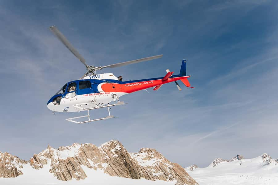
The flight begins with the helicopter base at The Helicopter Line Mount Cook, with the flight described as departing from Glentanner Park. If you are staying in Aoraki/Mount Cook Village, ask about the complimentary transport before you set out. That small detail can make the morning or afternoon much easier, since you do not have to arrange every part of the trip yourself.
Once airborne, the views change quickly. The Mackenzie Basin gives way to higher mountain country, and Aoraki/Mount Cook becomes the main focus. This is not simply a ride above a town or a short look at one peak. The route takes you toward the upper glacier country and into a part of the national park that is difficult to reach by road or walking track.
I would keep your camera ready from the start, but do not spend the entire flight looking through it. A helicopter window gives you a broad view that a phone screen cannot match. The pilot provides commentary in English, so you can connect the peaks and ice features you see with the places being described.
The six-person group size matters here. With only a few people aboard, you are less likely to feel packed into a sightseeing machine. It also makes the trip feel more focused, though your exact seat and view will depend on the helicopter arrangement and the pilot’s safety decisions.
More Scenic Flights in Mount Cook
- Mount Cook: Scenic Helicopter Flight with Alpine Landing
★ 4.8 · 442 reviews - Mount Cook: Ski Plane and Helicopter Glacier Combo Flight
★ 4.6 · 271 reviews - Mount Cook and The Glaciers 55-Minute Helicopter Flight
★ 4.5 · 133 reviews
Hochstetter Icefall and the upper Tasman Glacier
The first major sights are the Hochstetter Icefall on Aoraki/Mount Cook and the upper Tasman Glacier. Icefalls are areas where a glacier moves over steeper ground, breaking into a mass of ice blocks and sharp folds. From the air, this gives you a much better sense of scale than a distant view from a valley floor.
The upper Tasman Glacier is another strong part of the route. You see the glacier in its higher alpine setting, where the surrounding peaks and snowfields help explain how much ice lies above the lower valley. The view is not just about a single white surface. You get a sense of the glacier’s direction, its folds, and the mountain walls that contain it.
This is one reason I think a flight works especially well in Aoraki/Mount Cook National Park. From the ground, you can walk toward mountain views, but the upper glacier areas remain far away. From the helicopter, the relationship between peak, icefall, glacier, and basin becomes much easier to understand.
The tradeoff is that the scenery passes quickly. You may get an excellent look at the icefall, then move on within moments. Listen to the pilot’s commentary and keep your attention outside rather than trying to capture every feature on video. The route may vary, and the pilot has the final say based on weather and safety.
The alpine landing in snow
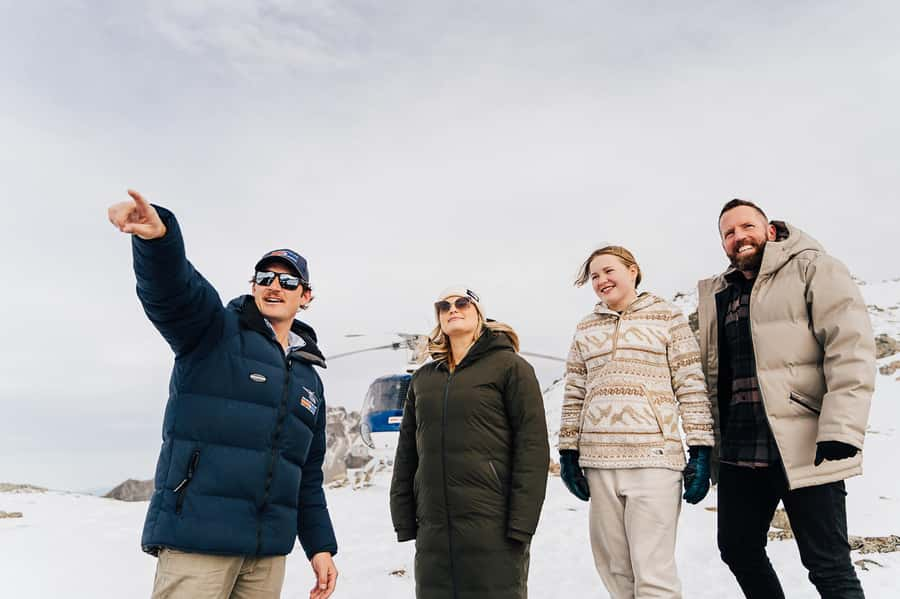
The landing is the part that turns this from a scenic flight into a short mountain outing. If snow levels are suitable, the helicopter lands at a remote alpine location, where you can step out for photos and take in the cold, clean air.
Do not think of this as a long mountain walk. It is a brief stop built around the setting, the views, and the chance to stand in a high alpine place. You may find yourself surrounded by snow and open mountain views, with very little else to distract you. That sense of remoteness is the point.
Bring warm clothing even if the valley feels mild. Temperatures can be much lower at the landing site, and the supplied advice specifically calls for warm layers and closed-toe shoes. A camera is welcome, but drones, selfie sticks, and tablets or iPads are not allowed for safety reasons.
The snow landing is not guaranteed. Snow levels may be unsuitable, and weather can affect both the landing and the route. If the helicopter cannot land in snow, that does not necessarily mean the flight is cancelled, but you should expect the pilot to adjust the plan. Flight times are approximate and include the landing.
That uncertainty is important when you decide how much to spend. If your main reason for booking is to stand in snow beside Aoraki/Mount Cook, you need to accept that nature controls the result. If you value the aerial route even without the landing, the $391 price is easier to justify.
Returning through the Burnett Mountains
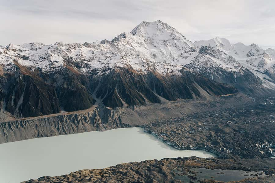
The return route adds a different mood. Instead of seeing only the ice and high peaks, you fly through the remote Burnett Mountains, which face toward Aoraki/Mount Cook. This gives you another angle on the mountain and shows how broad the surrounding country really is.
Below, the Mackenzie Basin appears expansive and dry compared with the snowy alpine zone. That contrast is one of the most interesting parts of the flight. In a short time, you move from glacier country to open basin country, with the Burnett Mountains acting as a visual link between the two.
I like this return route because it avoids making the flight feel like the same view twice. The outbound section focuses on the national park’s ice and high peaks. The way back lets you see the distance and scale of the region. You are not simply circling one mountain for 40 minutes.
The route can still change. Weather, visibility, and the pilot’s judgment matter more than a fixed sightseeing script. That flexibility is useful for safety, but it means you should not treat every named feature as guaranteed on every departure.
Same corner of the country, a very different day out:
- Mount Cook & Lake Tekapo Day Tour from Christchurch
★ 4.9 · 483 reviews - Mt Cook Small Group Scenic Day Tour from Queenstown
★ 5.0 · 407 reviews - Mount Cook, Lake Tekapo and Tasman Glacier Tour from Christchurch
★ 5.0 · 353 reviews - From Christchurch: Mt Cook Day Tour & Lake Tekapo
★ 4.6 · 331 reviews
What the 40 minutes really includes
Forty minutes sounds generous for a helicopter flight, but remember that the time includes the alpine landing. Some of the flight is spent moving between the base, Aoraki/Mount Cook, the glacier areas, the landing site, and the Burnett Mountains.
That is enough time for a compact overview rather than an extended expedition. You get several major sights, an aerial view of the national park, a photo stop, and a chance to land if conditions permit. The experience is designed for people who want a strong taste of the region from above, not a full day in the mountains.
The short length can be an advantage. You can fit the flight into a wider Aoraki/Mount Cook visit without losing an entire day. It also suits you if you want a dramatic view but do not want a long hike or a technical mountain activity.
The limit is depth. You will not spend hours exploring the glacier or walking across a snowfield. If you want extended time on ice, this is not the right type of trip. Here, the value comes from combining many hard-to-reach views in one carefully planned loop.
Is $391 a good value?
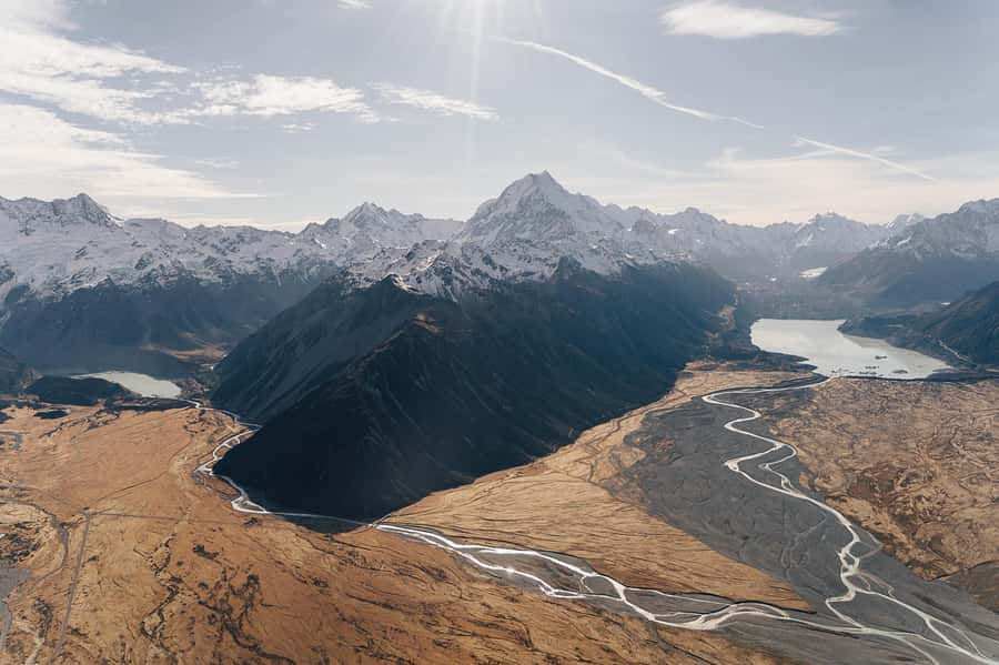
At $391 per person, this is one of the more expensive activities you can add to a South Island itinerary. I would not call it a casual add-on. You are paying for a helicopter, a specialist flight route, pilot commentary, a small group, and the chance to land in an alpine setting.
The value is strongest if you have limited time in the region. A road journey and walking tracks can show you the valley, but they cannot give you the same view of Hochstetter Icefall, the upper Tasman Glacier, the Burnett Mountains, and the Mackenzie Basin in one trip.
It also makes sense if you care about access rather than just duration. Forty minutes may seem short next to the price, but the helicopter reaches remote terrain that would take far longer, or be impossible, to visit on a normal holiday schedule.
I would think twice if you are booking mainly for a guaranteed snow landing. That part depends on snow levels, and the weather may also alter the route. The price becomes easier to accept when you see the landing as a possible bonus and the aerial tour as the core experience.
The company, pilots, and staff receive the strongest praise in the available feedback, and that is worth noting for a flight activity. You want a provider that handles changing mountain conditions carefully. The perfect 5 rating shown for the experience is based on four ratings, so it is encouraging but still a small sample.
Who will enjoy this flight most?
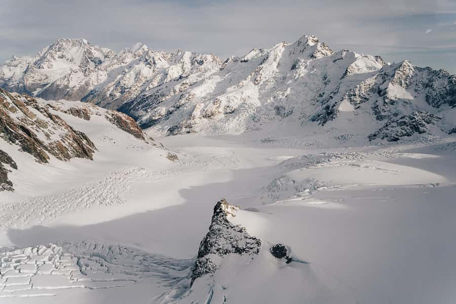
I would recommend this trip to you if you want a high-impact view of Aoraki/Mount Cook without committing to a long walk. It suits photographers, first-time visitors to the national park, couples, families who meet the age and weight requirements, and anyone who wants to see the upper glacier country from above.
It is also a good choice for a special occasion. The small group, remote landing, and mountain views give it a sense of occasion that a standard scenic drive may not provide.
You should be comfortable with a few unknowns. The weather may alter the route, the landing may not take place, and minimum passenger numbers apply. Bookings are coordinated where possible to meet those numbers, but you should avoid building an inflexible schedule around the flight.
Infants under four years old and under 15 kilograms must sit on an adult’s lap. The activity is wheelchair accessible, but you should confirm the practical arrangements when booking if you need specific assistance.
English is the tour language. The pilot gives commentary during the flight, so you can expect explanation as well as scenery rather than a silent ride.
Simple preparation for a better flight
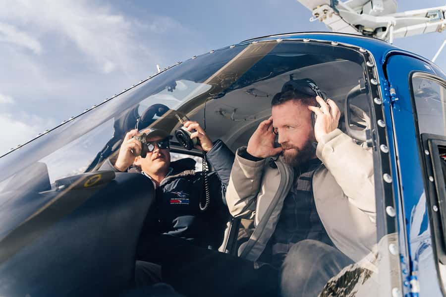
Wear warm clothing even if your accommodation is in the valley and the day feels comfortable. The alpine landing, if it goes ahead, can feel much colder, and closed-toe shoes are required.
Bring a camera, but keep your setup simple. Drones, selfie sticks, and tablets or iPads are not allowed on board. A compact camera or phone is more practical, and you should be ready to put it away during takeoff, landing, or any safety instruction.
Keep your schedule flexible around the flight. Confirmation is sent within 48 hours of booking, subject to availability, and flight routes and landing decisions depend on conditions. Free cancellation is available up to 24 hours before departure, and you can reserve now and pay later, which helps if the rest of your South Island plans are still shifting.
The price includes concession fees that support conservation and sustainability management. That does not remove the cost concern, but it does explain that part of the fare contributes to the national park setting that makes the experience possible.
Should you book the Mount Cook Mountains High flight?
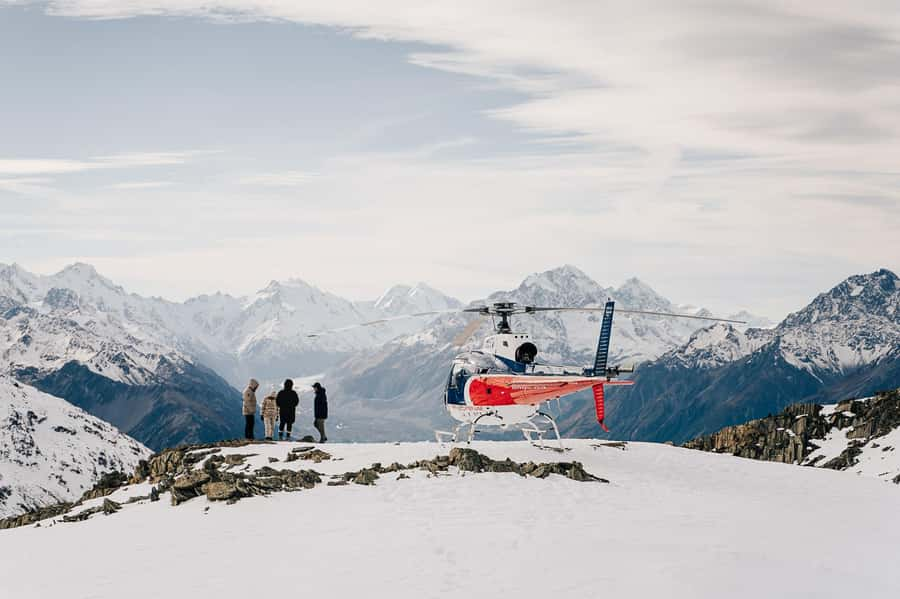
Book it if you want a short, carefully planned aerial view of Aoraki/Mount Cook and the surrounding glacier country, especially if you value the chance to land in snow. The combination of Hochstetter Icefall, the upper Tasman Glacier, Burnett Mountains, and Mackenzie Basin gives the route more variety than a simple peak flight.
Skip it if $391 would put pressure on the rest of your trip, or if you need a guaranteed landing and fixed route. Mountain weather can change the plan.
For most people considering a helicopter flight in this region, I would treat the snow landing as an added bonus rather than the sole reason to book. The real value is seeing the scale of Aoraki/Mount Cook National Park from above, then returning with a better sense of how the glaciers, mountains, and basin fit together.
FAQ
How long is the Mount Cook Mountains High flight?
The flight lasts 40 minutes. The stated time includes the alpine landing.
Where does the flight start?
The starting location is The Helicopter Line Mount Cook. The flight description also identifies Glentanner Park as the departure point.
Does the experience include an alpine landing?
Yes. An alpine landing is included, but a snow landing depends on snow levels and weather conditions.
Will the helicopter land on snow?
It may. Snow levels determine if a snow landing is possible, and the pilot can change the landing or route based on conditions.
What sights can I expect to see?
The route includes views of the Hochstetter Icefall on Aoraki/Mount Cook, the upper Tasman Glacier, the Burnett Mountains, and the Mackenzie Basin.
Is transport from Aoraki/Mount Cook Village available?
Yes. Complimentary transportation can be provided to and from Aoraki/Mount Cook Village.
How many people are in the group?
The flight is limited to six participants, making it a small-group experience.
Is the tour conducted in English?
Yes. The live tour guide and pilot commentary are in English.
What should I bring?
Bring warm clothing, a camera, and closed-toe shoes.
Can I bring a drone, selfie stick, tablet, or iPad?
No. Drones, selfie sticks, tablets, and iPads are not allowed on board for safety reasons.
Just added around Mount Cook
- Skydive Mt. Cook – 20+ Seconds of Freefall from 10,000ft★ 5.0 · 5 reviews
- Skydive Mt. Cook – 70+ Seconds of Freefall from 16,500ft★ 5.0 · 5 reviews
- Mt Cook to Queenstown Small Group Tour (One-Way)★ 4.5 · 25 reviews
- Mt Cook to Christchurch One-Way Small Group Tour via Lake Tekapo★ 5.0 · 16 reviews
- Mt Cook & Lake Tekapo 2-Day Small Group Tour from Queenstown★ 5.0 · 15 reviews
- Mount Cook: Mountains High 40-Minute Helicopter Flight★ 5.0 · 53 reviews
- Mount Cook Scenic 35 Minute Helicopter Flight★ 5.0 · 6 reviews
- Mount Cook Alpine Explorer Helicopter Flight with Alpine Landing★ 4.0 · 22 reviews
Scenic Flights, compared.
Milford Sound Flight and Cruise ex Queenstown (incl Lunch)
Read our review →
Franz Josef Glacier: Helicopter Flight & Alpine Landing
Read our review →
Franz Josef & Fox Glaciers Helicopter Flight & Snow Landing
Read our review →
Pilot’s Choice: 2 Glaciers & Snow Landing – 35min
Read our review →
Milford Sound Small Group Tour from Queenstown with Scenic Flight
Read our review →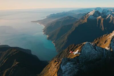
Browse the lists this tour appears in